Background
Senegal is located in western Africa on the Atlantic Coast between the latitudes of 12°30° and 16°30°N and
the longitudes of 11°30° and 17°30°W. It is bounded to the north and northeast by the Sénégal River, which
separates it from Mauritania; to the east by Mali; to the south by Guinea and Guinea-Bissau; and to the west
by the Atlantic Ocean. The Cape Verde (Cap Vert) Peninsula is the westernmost point of the African continent.
The Gambia consists of a narrow strip of territory that extends from the coast eastward into Senegal along the
Gambia River and isolates the southern Senegalese area of Casamance.
The country lies at an ecological boundary where semiarid grassland, oceanfront, and tropical rainforest converge;
this diverse environment has endowed Senegal with a wide variety of plant and animal life.
Although Senegal traditionally has been dependent on peanuts (groundnuts), the government has had some success
with efforts to diversify the country’s economy. Even so, the country suffered an economic decline in the 20th century,
owing in some measure to external forces such as the fall in value of the
African Financial Community (Communauté Financière Africaine; CFA) franc and the high cost of debt servicing,
as well as to internal factors such as a rapidly growing population and widespread unemployment.
Senegal has over 19 million ha of land of which only 3.9 million ha is suitable for arable crops while the rest
is undeveloped bush and arid areas used for livestock grazing (Alessandro et al., 2015). Out of the arable land,
40% is constantly cultivated with around 10% of the cultivated area receiving less than 500 mm of rainfall.
This limits crop production.
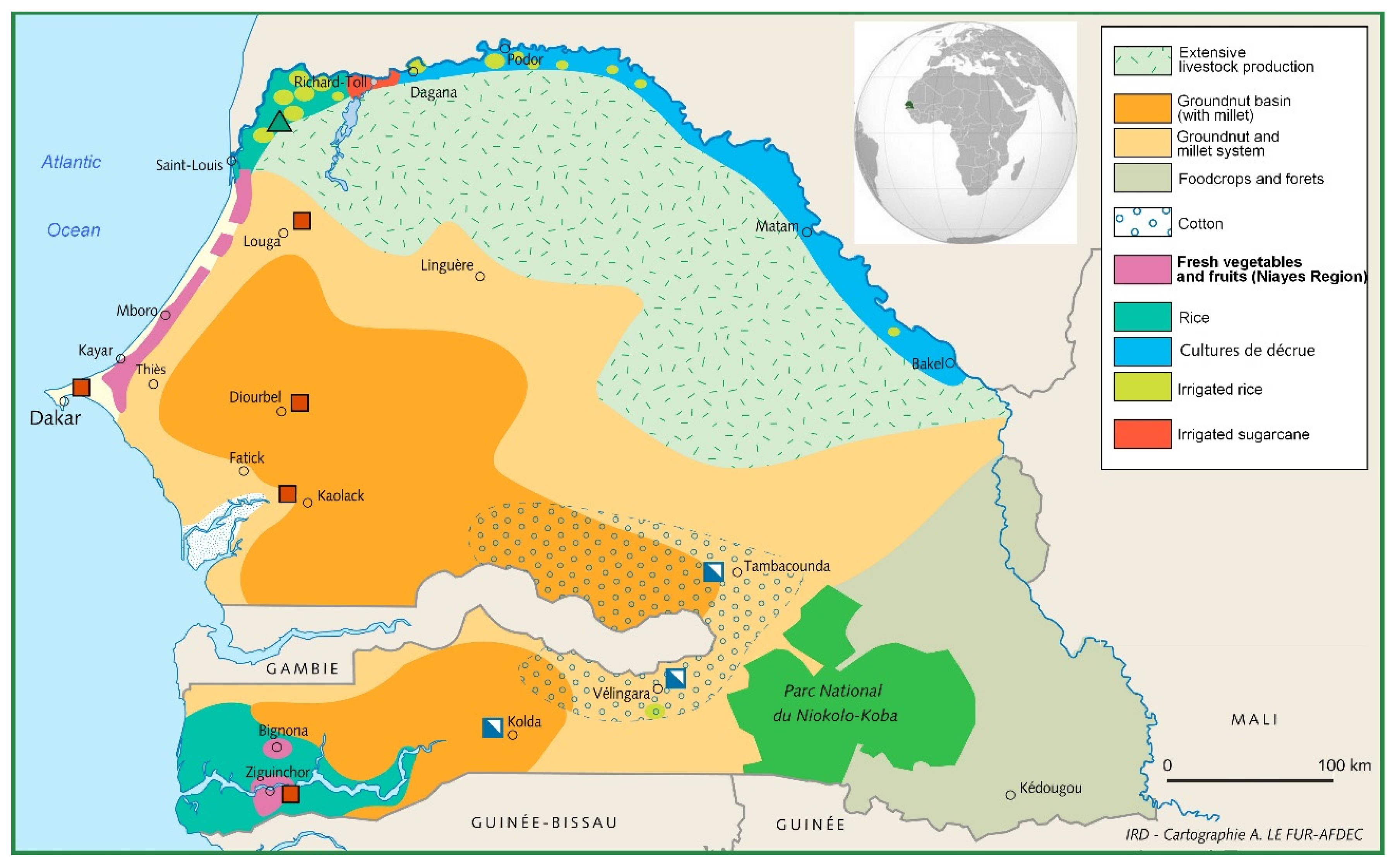
Agro ecological zones
Senegal is divided into six agro-ecological zones based on biophysical and socioeconomic characteristics.
Moving from north to south, they are:
The Senegal River Valley
Characterized by alluvial plains and sandy uplands with irrigated rice production, it covers a surface area of 9,658 km2
Rain-fed agriculture in this area is almost nonexistent, and most agricultural production occurs with irrigation. Although salinity is a problem in some areas, much of the land has high fertility levels because of regular flooding and siltation.
The Niayes
Situated on the Atlantic coast features a temperate climate and produces fruits and vegetables.
This 100km - 280km strip occupies 2,759 km2. Niayes is a densely populated area and faces challenges including soil and water salinity and coastal erosion.
The sylvo-pastoral zone
Situated on the north-central Senegal.
Supports extensive livestock production and covers 55,561 km2.
The Groundnut Basin
Situated in south-central Senegal is a zone of savannah dominated by groundnut and millet production.
It covers an area of 46,367 km2 and is densely populated. Ecosystem degradation and depletion of land resources, mainly soil fertility and timber resources, affect the area. Because of upland soil acidification and lowland salinity, soil regeneration has declined.
Eastern Senegal
Characterized by savannah with trees.
Its agricultural production involves primarily cotton and livestock. It covers an area of 56 529km2 and is subject to rampant rural poverty because of extreme population pressure on natural resources, despite its robust agro-pastoral potential.
The Casamance
Characterized by forests and savannah with trees.
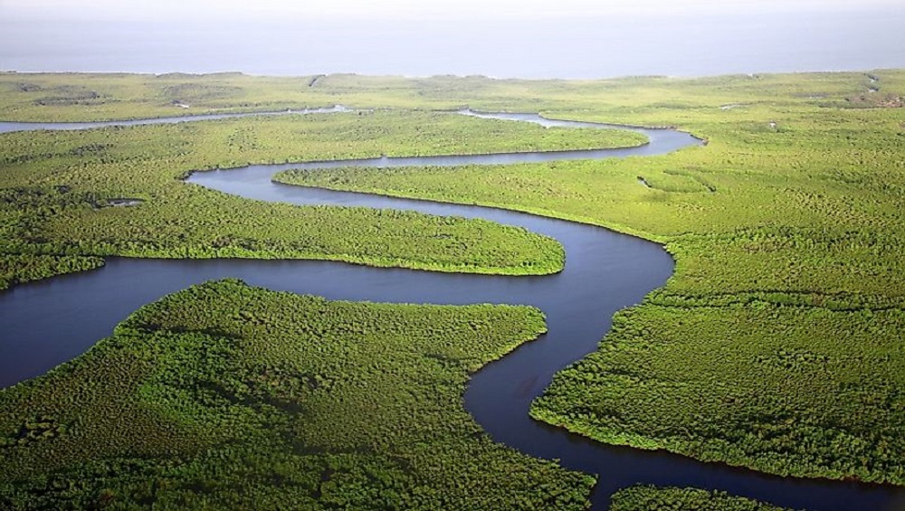
Its agricultural production includes mainly rain-fed rice along with diverse other crops. With a total surface area of 28,324 km2, it is divided into three zones—lower, middle, and upper. The region faces challenges such as lowland soil acidification, water erosion, a loss of forest diversity, increased soil salinization, iron toxicity, and acute mangrove degradation.
Elevation
The topography of Senegal is generally flat with rolling sandy plains but rises to hills in the southeast. Most areas have elevations of less than 100 m above sea level. Elevations of more than about 330 feet (100 meters) are found only on the Cape Verde Peninsula and in the southeast of the country. The highest point in the country, reaching an elevation of 1,906 feet (581 meters) is found near Népen Diakha to the southeast.
Releif
The country is drained by the Sénégal, Saloum, Gambia (Gambie), and Casamance rivers. Of these rivers, the Sénégal—which was long the main route to the interior—is the most important. The river rises in the Fouta Djallon highlands of Guinea and, after traversing the old massifs, rapidly drops downward before reaching Senegalese territory. At Dagana it forms the so-called False Delta (or Oualo), which supplies Lake Guier on the south (left) bank.
Salinization
The slope of the land is so gentle on this stretch of the river (around Lake Guier) that, at times of low water, salty sea water flows about 125 miles (200 km) upstream.
The island on which the town of Saint-Louis stands, near the mouth of the river, is situated about 300 yards (270 meters) from the sea in the False Delta; the river’s true mouth lies 10 miles (16 km) to the south. In the southern half of the country, estuaries are muddy and salty, with marshy saline depressions known as tannes occurring occasionally.
Soils of Senegal
The soils of the Sénégal and Saloum river valleys in their middle courses are alluvial and consist of sandy loams or clays. Near the river mouths the soils are salty and favourable for grazing. Similar conditions are associated with the Gambia and Casamance rivers, except near their mouths the banks are muddy, whereas their upper courses have sandy clay soils.
Many types of soils are found throughout the country. In the northwest the soils are ochre-coloured and light, consisting of sands combined with iron oxide. These soils, called Dior soils, constitute the wealth of Senegal; the dunes they form are highly favourable to peanut cultivation, whereas the soils between the dunes are suitable for other food crops, such as sorghum. In the southwest the plateau soils are sandy clays, frequently laterized (leached into red, residual, iron-bearing soils). The centre and the south of the country are covered by a layer of laterite hidden under a thin covering of sand that affords only sparse grazing during the rainy season. In the Casamance area heavily leached clay soils with a high iron-oxide content predominate, suitable for cultivation regardless of their depth.
Demographics of Senegal
Senegal has an area of 197,000 sq. km. and a population of about 16,619,225 million as of 2019. The population of Senegal has been growing at a rate that is higher than the world average but is comparable to other countries in the region. Life expectancy figures for Senegal, averaging about 61 years for both men and women, are among the highest in sub-Saharan Africa. The population is heavily weighted toward the young, with more than two-fifths under 15 years of age. There has been a major increase in permanent urban settlement, which is approaching half of the population.
Population growth
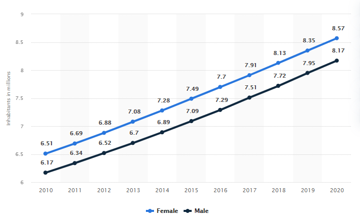
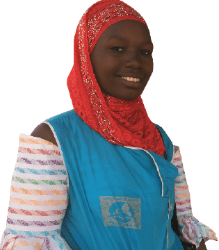
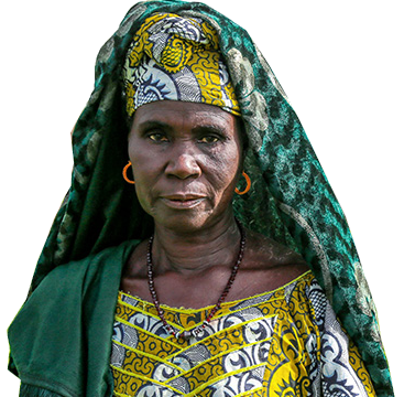
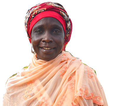
Senegalese Women
The population of women in Senegal was approximately 8.57 in 2020.This represents 52% of Senegal’s population.
Illiteracy is a major problem in Senegal, particularly for women
Fewer than four out of 10 women (39%) in Senegal are considered literate, compared to 62% of men
This means that more than two million Senegalese women lack basic literacy skills (UNESCO, 2012). There are too many young girls at risk of dropping out of school, and too many girls and women with an extremely low level of schooling who are already out of the school system. These problems are compounded by the number of girls and women who are in situations of extreme poverty and vulnerability.
With high rates of illiteracy, women make up less than 10% of the formal labor force
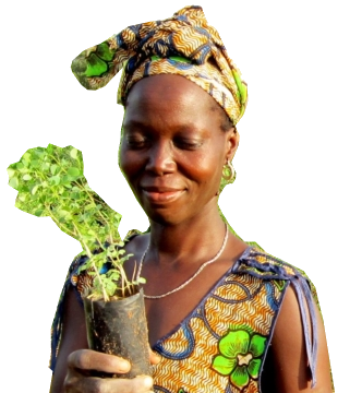
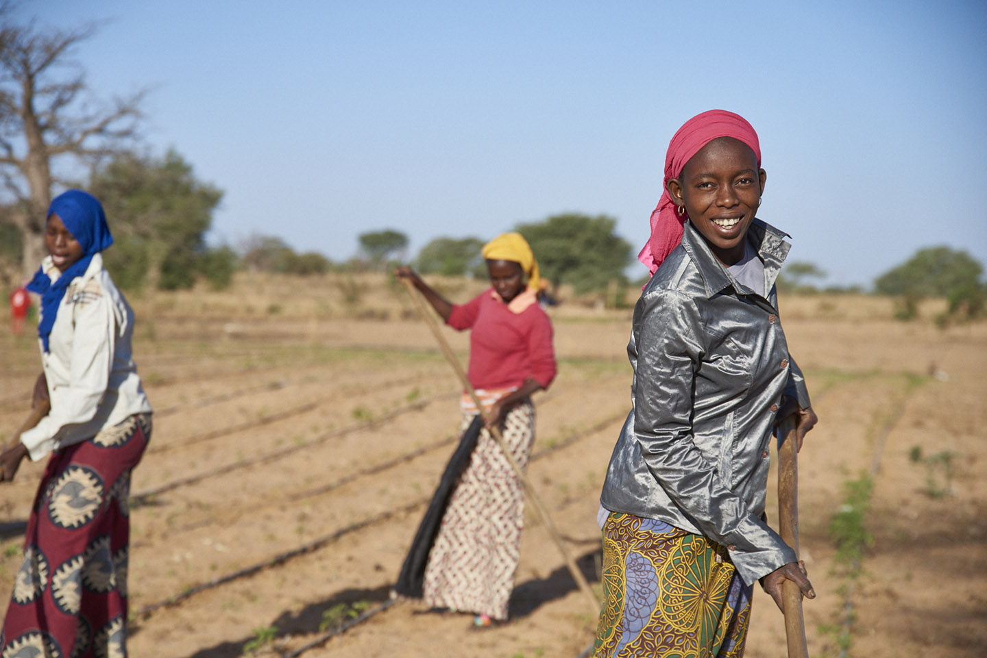
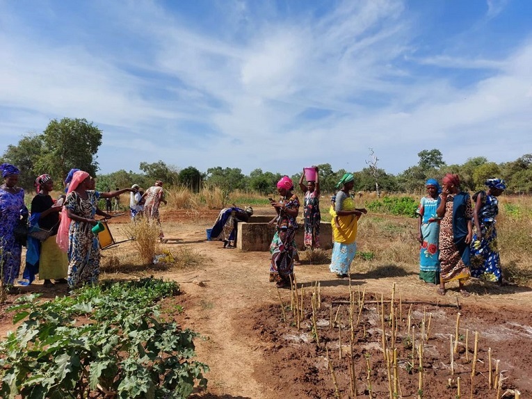
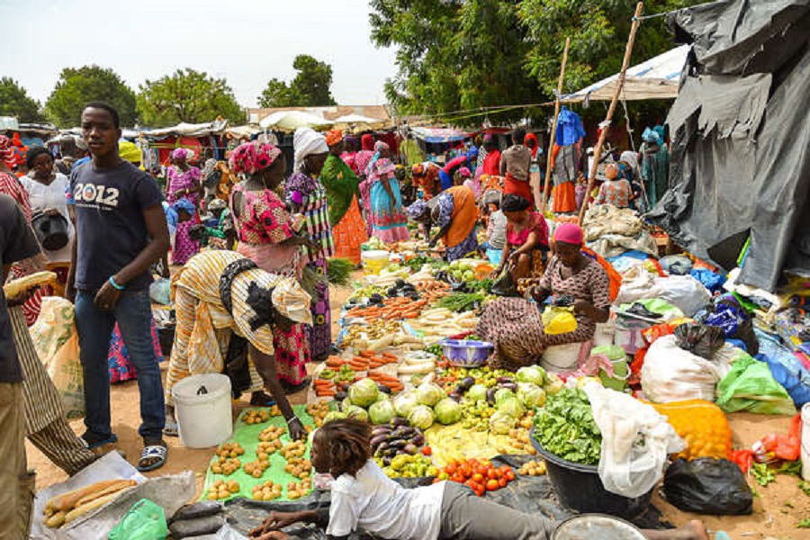
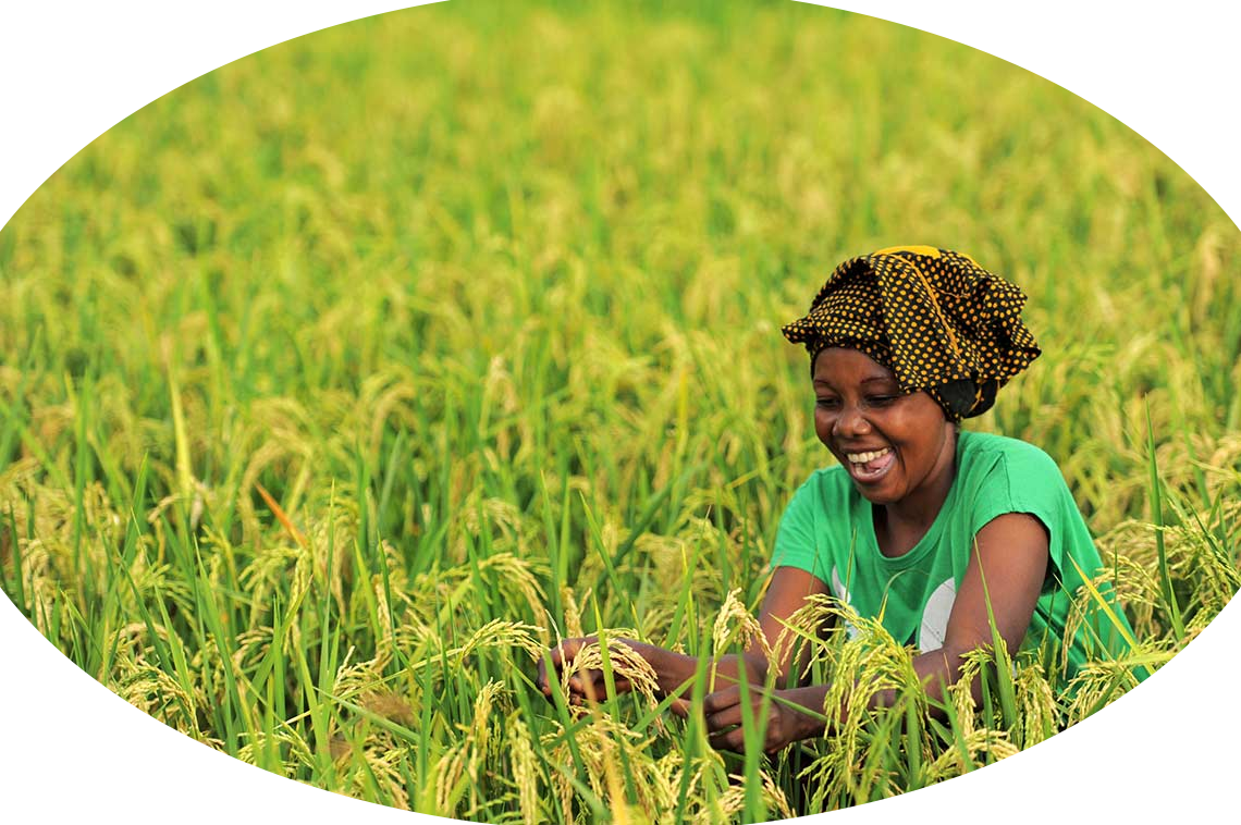
Women farmers make up to 70 per cent of the workforce
They produce more than 80 per cent of crops in Senegal, especially food crops. Yet, women farmers lack access to land, skills, financial resources and markets, compared to their male counterparts. Women living in rural areas are highly active in the processing and marketing of agricultural, livestock and fishery products
Women in Senegal face a number of disparities in their social status
They are confronted with hurdles of various nature that include:
- Access to land and land tenure security
- Access to financing mechanisms
- Access to factors of production and extension services
- Effects of climate change
- Access to markets.
There has been a rise in women participation in labour force in Senegal
Women in Senegal are responsible mainly for sustaining the household and performing other chores for the family, while men earn all the income.
In 2019, 57.4 percent of all women participated in the labor force. This was up from 57.1 percent who participated in 2018, but 2.6 percentage points below the peak of 60.0 percent in 1999. In rural areas, the distribution of employment in different economic sectors reveals women’s involvement in agriculture, livestock farming and the environment where they represent 70% of the workforce.
There has been a rise in women participation in leadership
In 2017, about 6 million Senegalese citizens voted at the legislative elections.
As a result, 70 women (42%) out of 165 parliamentarians were elected compared to 64 women (39%) in 2012. Women also represent 21% of ministers in the National Government (8 women out of 39 members)
The Young people of Senegal
More than 60 percent of Senegal’s population is under the age of 25. In 2019, Senegal’s population was over 16 million with 40% of the population younger than 15.
Formal job sector
More than 300,000 Senegalese youth enter the workforce each year. The formal sector in Senegal makes up between three to four percent of Senegal’s job market. As a result, college graduates struggle to find jobs relating to their field of study. Although the youth unemployment rate for ages between 15-24 has decreased from 13.2% in 2010 to 8.2% in 2019, Senegal still faces a problem of unemployment among youth (the Borgen project, 2020).
Informal Job Sector
When it becomes difficult to find employment, many Senegalese youth turn to the informal sector or start their own businesses. The informal sector is made up of businesses that are not registered and therefore do not pay taxes. For obtaining an informal job, social and personal relations play a more important role than a contractual agreement. Furthermore, informal jobs often tend not to provide employees with any form of social security or insurance, and are also fairly low-paying. Many informal jobs generate income that is less than Senegal’s minimum wage.
Consequences of Youth Unemployment
Youth unemployment often leads to poverty, crime and even migration to other countries. In Senegal, many have left their villages to migrate to Europe. However, the path to Europe is dangerous and many die attempting to reach or cross the Mediterranean. To respond to the crisis of youth unemployment, the Senegalese government and NGOs have created programs to help young people find jobs.
GDP
The Economy of Senegal
The Senegalese economy has traditionally revolved around a single cash crop, the peanut. The government, however, has worked to diversify both cash crops and subsistence agriculture by expanding into commodities such as cotton, garden produce, and sugarcane as well as by promoting nonagricultural sectors. The government was successful in making fishing, phosphates, and tourism major sources of foreign exchange at the beginning of the 21st century, although the condition of the transportation and power infrastructure placed limits on the amount of expansion possible. The exploitation of mineral resources such as gold, petroleum, and natural gas also diversified the economy.
"The economy of Senegal is driven by mining, construction, tourism, fishing, agriculture and services provision, which are the main sources of employment in rural areas, despite abundant natural resources in iron, zircon, gas, gold, phosphates, and numerous oil discoveries recently"
Senegal's economy gains most of its foreign exchange from fish, phosphates, groundnuts, tourism, and services. As one of the dominant parts of the economy, the agricultural sector of Senegal is highly vulnerable to environmental conditions, such as variations in rainfall and climate change, and changes in world commodity prices.
Poverty in Senegal
"Nearly half of the Senegalese population – 46.7 percent, to be exact – are living in poverty."
Despite significant economic growth and decades of political stability, Senegal still faces serious development challenges. More than one third of the population
lives below the poverty line, and 75 percent of families suffer from chronic poverty. Poverty and food insecurity are particularly prevalent in rural areas in the north,
east and south of the country. The agriculture sector is dominated by subsistence farming, with limited access to good quality seeds and fertilizers, technology, finance and credit,
agricultural insurance and post-harvest storage techniques. Reliance on traditional, unsustainable practices – including overgrazing and bush fires – contributes to land degradation.
Climate change is also closely related to rural poverty and under-development: with 70 percent of the crops being rain-fed, the sector is highly vulnerable to climate shocks,
which have severe impacts on the availability and prices of food. In rural areas, 66 percent of residents are considered poor compared to 23 percent of residents in Dakar.
Multi-dimensional poverty index (MPI)
The Climate of Senegal
"Senegal has a tropical climate with pleasant heat throughout the year with well-defined dry and humid seasons that result from northeast winter winds and southwest summer winds"
Senegal’s climate is conditioned by the tropical latitude of the country and by the seasonal migration of the intertropical convergence zone (ITCZ)—the line, or front, of low pressure at which hot,
dry continental air meets moist oceanic air and produces heavy rainfall. The prevailing winds are also characterized by their origin: the dry winds that originate in the continental interior and the
moist maritime winds that bring the rains.
The dry winds, sometimes called the dry monsoon, consist of the northeast trade winds. In winter and spring, when they are strongest, they are known as the harmattan. They bring no precipitation
apart from very light rain, which the Wolof people of Senegal call the heug. The moist rain-bearing winds blow primarily from the west and northwest. Beginning in June with the northward passage
of the ITCZ, these winds usher in the summer monsoon. As the ITCZ returns southward beginning in September, the rainy season draws to a close. The slow north-south migration of the ITCZ results
in a longer, heavier rainy season in the southern part of the country. From the combination of these factors, three principal climate zones may be distinguished: coastal, Sahelian, and Sudanic.
Interior temperatures are higher than along the coast (for example, average daily temperatures in Kaolack and Tambacounda for May are 30 °C (86.0 °F) and 32.7 °C (90.9 °F) respectively,
compared to Dakar's 23.2 °C (73.8 °F)). In Tambacounda in the far interior, particularly on the border of Mali where the desert begins, the temperature peaks at around 45-47°C (133 - 116.6°F) and can reach as high as 54 °C (129.2 °F).
Rainfall increases substantially farther south, exceeding 1,500 mm (59.1 in) annually in some areas. The northernmost part of the country has a near hot desert climate, the central part
has a hot semi-arid climate and the southernmost part has a tropical wet and dry climate. Senegal is mainly a sunny and dry country.
- The coastal (Canarian) zone occurs along a strip of Atlantic coastline about 10 miles (16 km) wide running from Saint-Louis to Dakar. Its winters are cool, with minimum temperatures reaching about 63 °F (17 °C) in January; maximum temperatures in May do not exceed 81 °F (27 °C). The rains begin in June, reach their height in August, and cease in October. The average annual rainfall is about 20 inches (500 mm).
- The Sahelian climate occurs in an area bounded to the north by the Sénégal River and to the south by a line running from Thiès (a town on Cape Verde Peninsula) to Kayes in the neighboring country of Mali. The weather there in January is also cool, especially in the mornings before sunrise, when the temperature drops to about 57 °F (14 °C); afternoon temperatures, however, may top 95 °F (35 °C). In May minimum temperatures are no lower than about 72 °F (22 °C), and maximums often rise above 104 °F (40 °C). The dry season is quite distinct and lasts from November to May. Certain places, such as Podor and Matam on the border of Mauritania, are particularly noted for their dryness and heat. Between July and October, the rainfall averages about 14 inches (360 mm), moderating the temperature somewhat, while maximum temperatures reach about 95 °F (35 °C).
- The Sudanic zone in the southern half of the country is generally hot, humid, and uncomfortable. Annual precipitation varies from north to south. In the Kaolack-Tambacounda vicinity, rainfall averages between 29 inches (740 mm) and 39 inches (990 mm), occurring on about 60 days between June and October. Cultivation without irrigation is possible here. Annual rainfall in the Gambian area frequently amounts to 50 inches (1,270 mm), resulting in the growth of a continuous belt of light forest and patches of herbaceous undergrowth. In the southern Casamance area it exceeds 50 inches, falling on 90 days of the year. The forest there is dense, green, and continuous, without undergrowth, and oil palms, mangroves, and rice fields are characteristic.
Senegal Agriculture
In 2016, agriculture represented 18% of GDP (Gross Domestic Product), employing 52% of the total labour force. About 80% of people in rural areas work in this sector. In 2013, commercial farming represented 10% of the land under production. 90% of agricultural land is worked by small-scale, family based farms engaged in subsistence agriculture
Farming Systems
Farming systems are mostly rain-fed. Senegal's dominant commodities are groundnuts (grown as a cash crop), rice, livestock keeping and millet, followed by fruits (such as watermelons and mangoes) and vegetables (tomatoes and onions). Despite this, the country imports about 70% of the rice it requires for domestic consumption
Challenges in Agriculture
The vast majority of crops are rain-fed, making water availability one of the country's biggest agricultural challenge. Other challenges include:
- Deforestation leading to land degradation
- Reduced soil fertility as a result of continuous cropping
Irrigation
Senegal’s irrigation subsector is divided into two farming systems; Irrigated cereals dominated by paddy rice, intercropped with maize and sorghum; and smallholder irrigated horticulture with a large range of vegetables, dominated by onion and tomato. Small-scale irrigation provides 90 percent of the vegetables sold in local market with rice and vegetables dominating the small irrigated crop sector
The agricultural sector of Senegal contributes to about 17% of the country’s GDP employing more than 70% of the workforce.
-
Senegal has over 19 million ha of land
Out of this, only 3.9 million ha is suitable for arable crops while the rest is undeveloped bush and arid areas used for livestock grazing. Out of the arable land, 40% is constantly cultivated with around 10% of the cultivated area receiving less than 500 mm of rainfall. This limits crop productionthe sector consists primarily of rainfed agriculture which is very vulnerable to risk associated with climatic change. Irrigation could be the solution to this but only 10% of the cultivated land is under irrigation with the main irrigation areas being along the Senegal river and the Casamance.
-
The major crops grown in Senegal are groundnuts and millet, which account for approximately 75% of all the cropped area.
Other crops such as maize, rice, sorghum, cowpeas and cotton are also grown making approximately 25% of the cropped area while other crops, such as vegetables account for less than one percent of the cropped area (Elberling et al., 2003). As food production does not meet country’s demand, the country is forced to import rice and wheat (Diagne et al., 2013). On the other hand, Senegal exports cotton, groundnut oil and horticultural products mainly green beans, tomatoes and mangoes
Water scarcity
"The vast majority of crops are rain-fed, making water availability one of the country’s biggest agricultural challenges."
In the Senegal River Basin, water is shared amongst a range of livelihood-related sectors in the region: agricultural and agro-pastoral zones, fisheries zones, municipal water supply and hydropower.
Water withdrawals along the Senegal River remain relatively low, and therefore, a higher water scarcity level.
In most areas, wells, both modern and traditional, are the principal sources of drinking water but face shortages in the dry season. The wells are also associated with hygiene and management issues.
Land degradation
"Climate change has led to prolonged periods of drought, over-intensive farming and over-grazing have caused land degradation and deforestation has turned the once fertile land into desert"
In Senegal, most of the land is facing a strong degradation linked to:
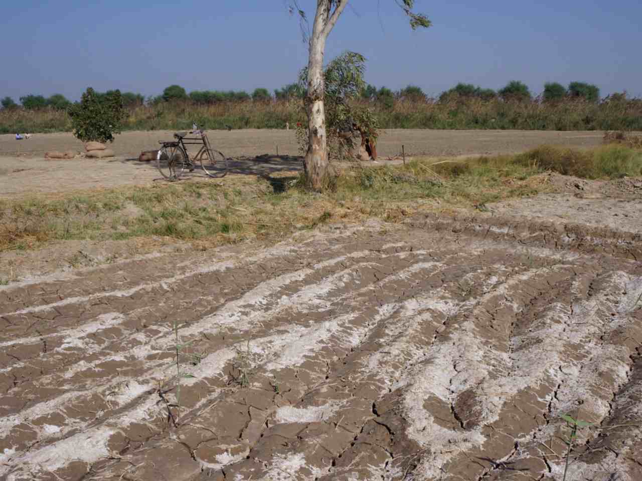
- Salinization of agricultural land and especially rice paddies;
- Water erosion which causes stripping and gullying;
- Wind erosion which removes the surface layer of soils and destroys their potential for production;
- Overgrazing that exceeds load capacities;
- Mono-culture of groundnuts.
Groundnut production has reduced soil fertility to the extent that farmers are moving further inland as they look for new land for cultivation.
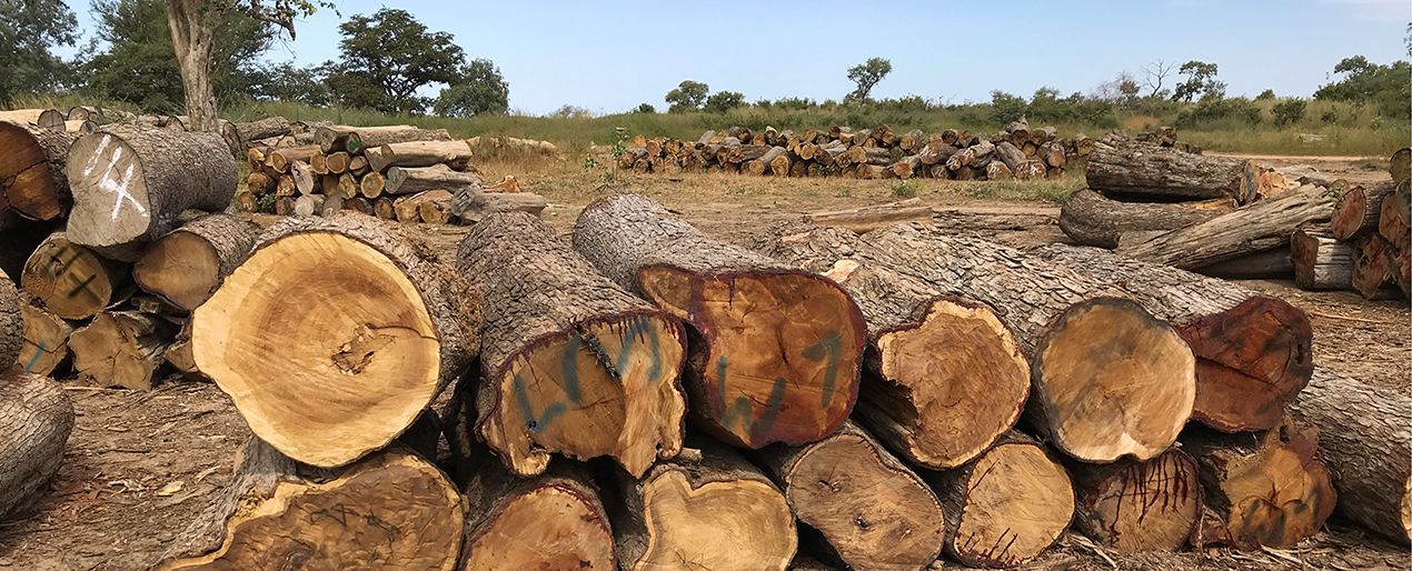
The increasing demand for land and fuel woods has contributed to deforestation with the World Bank estimating that, 450 square km of forests are lost annually,
predominantly for agricultural purposes. As a result of climate change, the annual rainfall in Senegal is declining, forests are shrinking and the land is becoming
vulnerable to poor soils and desertification.
Irrigation
Senegal relies heavily on rainfed agriculture in which only 12% of the country is arable hence the requirement for irrigation. The country’s irrigation potential is about 340,000 ha while the developed areas cover 105,000ha, with a 60% exploitation rate. Approximately 41,000 ha are farmed along the river, 10,000ha in the Niayes, 9,000 ha in Lower and Middle Casamance, with the rest shared between Anambé and eastern Senegal.
Types of development include large irrigated areas along the rivers and in Anambé (400 to a few thousand ha); medium-sized land in the same areas (60 to 300 ha); irrigated village plots (PIV) along the Senegal River and eastern Senegal (20 to 30 ha); private irrigated land (PIP) all along the river, around Lake Guiers and the Niayes (50 to 400 ha); bottomlands at Kédougou (10 to 50ha). Of Senegal’s irrigation potential, 30 percent is not yet irrigated. Of the equipped areas, about 60 percent were cultivated in 2009, mostly for rice and vegetables. This ratio has been improving over the last few years.
Agribusiness
Senegal’s agricultural sector consists of a sluggish sales of groundnut products and the deep crisis in fisheries due to over-fishing. Production of rice, maize and cassava has increased in recent years to meet rising local demands in urban areas.
The horticultural sub-sector presents the main hope of diversifying Senegal’s agricultural export structure. Despite Senegal’s huge potential in horticultural exports, market opportunities at national, regional and international levels remain under-exploited.
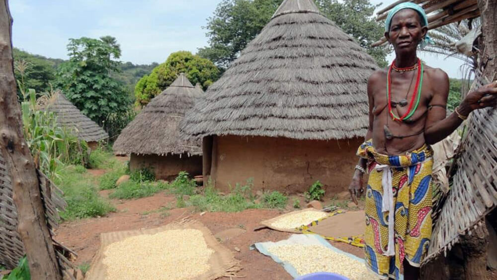
In Senegal, production and marketing assets (e.g. land, technology, finance, business know-how, human networks) are unevenly distributed across different types of producers, ranging from a few large commercial farms to small-scale family farmers who represent the majority.
The food-processing industry in Senegal is the second most developed among West African countries, after Côte d’Ivoire. This industry accounted for 7 per cent of GDP on average in 2005, employing about half the people working in Senegalese industries and two-thirds of seasonal workers.
"The AVENIR project is working to support farming households in Tambacounda and Sedhiou, focusing on women and young people."
Senegal is vulnerable to environmental shocks, particularly floods and droughts, which are expected to increase in scale and duration due to increased climate variability. These challenges are placing additional burdens on small farms, which already face land overuse, shorter rainfall and soil degradation challenges.
AVENIR - The Project
MEDA, and the International Center for Tropical Agriculture (CIAT), are working together to promote climate-smart agricultural production and entrepreneurship in the regions of Tambacounda and Sedhiou, Senegal. The goal of this project is to improve the socio-economic well-being and resilience of farming households
The AVENIR project is working to support farming households in Tambacounda and Sedhiou, Senegal, focusing on women and young people
The Background
The AVENIR project recognizes the central and leadership role of women and youth in agriculture and agribusiness, in farming households’ nutrition and socio-economic wellbeing, and in the management of natural resources (especially water and soil). The project aims to reduce the unintended negative environmental impacts of agricultural interventions and policies among vulnerable populations, particularly women and youth, and will directly benefit 10,000 women and youth from agricultural households (70% women), through the introduction of climate-smart agricultural and irrigation technologies and practices.
Context
Senegal is vulnerable to environmental shocks, particularly floods and droughts, which are expected to increase in magnitude and duration due to increased climate variability. Together with land overuse, shorter rainfall, and soil degradation challenges, these lead to increased pressure on small farms. Smallholder farmers in Senegal struggle to make profits. Women and young people have a limited ability to respond optimally to climate change, this is a result of impediments to equal decision-making and access to resources at the household and community levels including: Limited knowledge of farming as a business; Limited knowledge of climate-smart agriculture practices; Poor coordination across market actors; Poor irrigation; Difficulty in access to land, improved inputs, and mechanized equipment; Time constraints due to obligations to fulfill household duties.
The Approach
AVENIR will promote:
- Diversified, productive and profitable agricultural systems (rice, horticulture and agroforestry), adapted to agro-ecological conditions, and resilient to climate change.
- Increased supply of and demand for diversified nutritious foods
- Enhanced value-added activities, including product aggregation, storage, processing and marketing of rice, baobab, mango and cashew products to increase the profitability of agri-businesses.
- Increased participation of women and youth in decision-making concerning the governance of water and soil resources.
Expected outcomes
In 5 years (2019 to 2024) the expected outcomes are:
- Farmer groups led by women and youth supported
- Women and youth trained to run profitable businesses
- Aggregation and product processing units supported (producer groups and / or buyers)
- Households trained on the rights of women and youth
- Women and youth trained in climate smart agriculture and irrigation techniques and technologies
- Market actors receiving smart incentives (innovative, climatefriendly, business solutions)
- Women and youth trained in sustainable and equitable management of water resources.
Avenir project Components
The project components include:
Empowerment
Increase socio-economic empowerment of women and youth;
Irrigation and climate change
Promote sustainable intensification of irrigated and climate-change adapted crops, including agroforestry, horticulture and rice crops;
Governance
Improve local governance and territorial management of water resources.
Project areas
AVENIR aims at improving the socio-economic well-being and resilience of farming households, with an emphasis on women and young people, in in the regions of Tambacounda and Sedhiou, Senegal.
Sedhiou Region
Sédhiou Region covers an area of 7,340 km² with three administrative departments (Bounkiling, 2,889 km²; Sédhiou, 2,725 km² and Goudomp, 1,725 km²).
Sédhiou Region is located in the South-West of the country in the Casamance. It's located between Kolda region in the East and the Ziguinchor one in the West and borders Gambia to the North and Guinea-Bissau to the South. The climate is characterized by the African monsoon with an average annual rainfall >800 mm. The region is rich in forest resources and includes 12 forest reserves with a total surface of 84,500 ha.
Tambacounda Region
Tambacounda Region covers an area of 42,364 km² withfour administrative departments (Bakel, 6707 km²; Goudiry, 15,658 km²; Koumpentoum, 6,888 km², Tambacounda, 13,372 km².
The prevailing climate is known as a local steppe climate with an average annual rainfall of 786mm. The economy of Tambacounda is based primarily on agriculture, with cash crops including cotton and peanuts as well as animal rearing. Mining plays a role in the southern part of the region. The region is also home to the Niokolo-Koba National Park, the largest reserve in western Africa, which supports another leg of Tambacounda's economy, tourism. Tambacounda has a tropical savanna climate that borders a hot semi-arid climate. The area has two seasons, the rainy season from June to October, characterized by heat, humidity, and storms, and the sweltering, rainless dry season from November to May.
Climate in the project areas
Climate in Sédhiou Region
The rainy season in Sédhiou is hot, oppressive, and overcast, whereas the dry season is hot, humid, and partially cloudy. The temperature normally ranges from 16.7 °C to 38 °C throughout the year, with temperatures rarely falling below 13.9 °C or rising over 40.6 °C.
Temperature
The hot season lasts from March to May, with daily high temperatures averaging above 36.7 °C. May is the hottest month in Sédhiou, with average highs of 37.8 °C and lows of 23.9 °C. The cool season lasts from July to September, with daily maximum temperatures averaging below 32.2 °C. January is the coldest month in Sédhiou, with average lows of 16.7 °C and highs of 33.3 °C.
Rainfall
Sédhiou experiences extreme seasonal variation in monthly rainfall. The rainy period of the year lasts from May to November. The month with the most rain in Sédhiou is August, with an average rainfall of 330 mm. The dry period of the year lasts from November to May. The month with the least rain in Sédhiou is March.
Wind
The windier part of the year lasts from December to July, with average wind speeds of more than 9.8 kilometers per hour. February is the windiest month in Sédhiou, with an average hourly wind speed of 12.6 kilometers per hour. From July through December, the weather is calmer. October is the calmest month in Sédhiou, with an average hourly wind speed of 7 kilometers per hour.
Climate in Tambacounda Region
In Tambacounda, the rainy season is hot, oppressive, and overcast and the dry season is uncomfortably hot and partly cloudy. Throughout the year, the temperature ranges from 19.4°C to 40.5°C, with temperatures rarely falling below 16.7°C or rising over 42.2°C.
Temperature
The hot season lasts from March to June, with an average daily high temperature above 38 °C. The hottest month of the year in Tambacounda is May, with an average high of 40 °C and low of 27.7 °C. The cool season lasts from July to September, with an average daily high temperature below 33.3 °C. The coldest month of the year in Tambacounda is January, with an average low of 20 °C and high of 33.9 °C.
Rainfall
Tambacounda experiences extreme seasonal variation in monthly rainfall. The rainy period of the year lasts from May to November. The month with the most rain in Tambacounda is August, with an average rainfall of 203.2 mm. The dry period of the year lasts from November to May. The month with the least rain in Tambacounda is February.
Wind
The windier part of the year lasts from December to July, with average wind speeds of more than 12.4 kilometers per hour. The windiest month of the year in Tambacounda is January, with an average hourly wind speed of 16.4 kilometers per hour. The calmer time of year lasts from July to December. The calmest month of the year in Tambacounda is October, with an average hourly wind speed of 8.2 kilometers per hour.
Deforestation in the Project areas
Climate change is seeing an increase in the frequency of droughts and heat waves. In Senegal deforestation is the main cause of climate change
In 2010, Sédhiou had 3.44kha of tree cover, extending over 1.3% of its land area. In 2017, it lost 75.1mha of tree cover, equivalent to 13.8t of CO₂ of emissions. In 2010, Tambacounda had727ha of tree cover, extending over 0.017% of its land area. In 2012, it lost 75.0 mha of tree cover, equivalent to 14.7t of CO₂ of emissions.
About 45 percent of Senegal is forested. Of this, a little more than 18 percent is considered pristine primary forest—one of the higher rates in West Africa. While Senegal lost some 675,000 hectares of forest between 1990 and 2005, the country’s deforestation rate has only increased by 5 percent since the 1990s. Deforestation is mostly the result of clearing for fuelwood, charcoal, and logging, though poaching, wildlife trafficking, and hydroelectric projects have further degraded forest areas. Government officials have blamed deforestation for increased soil erosion, flooding, and periodic drought which has had an adverse impact on regional agriculture.
Challenges experienced in the project areas
1. Climatic challenges
Climatic challenges in Sedhiou and Tambacounda are those associated with climate change such as decreased rainfall and increasing temperatures. Short duration rainfall events with high intensity lead to flooding, while low rainfall seasons followed by high temperatures lead to droughts.
Temperature and precipitation
The temperature in Tambacounda averages 28.6 °C and annual rainfall is 786 mm. The area is susceptible to erratic rains and frequent dry spells, as well as variations in the timing and length of the rainy season which highly affects peanuts growing. At about 17 metres above sea level, Sédhiou has a tropical climate. The average annual temperature is 26.9 °C and annual rainfall is around 1180 mm.
Temperature in 1989
Temperature in 2018
Temperature change over 30 years
Precipitation in 1989
Precipitation in 2018
Precipitation change over 30 years
Droughts and floods
Senegal is located in the Sahelo-Sudan zone where drought has been occurring sporadically for several decades attributed to erratic rains. This has been documented for the years 1996-1998, 2002, 2007, 2011, 2014 and 2018. Droughts generally impact the arid and semi-arid Sahelian regions (northern Senegal) every three to four years. Since 1980, droughts have affected more than 3 million people. The drought of 2011 led to reduced food production in most parts of the country as well as inflation. In the Casamance where Sedhiou is located, rainfall deficit is known to favour salinization of groundwater and soils. In 2018, the drought led to depletion of pastures and also intensified clashes over resources between nomadic pastoralists
Floods occur more frequently than droughts, but droughts have more severe consequences and affect many more people per event. Flooding annually affects about 200,000 people and has an $89 million impact, with large-scale flooding in 2009 largely in the Dakar region causing about $104 million in damages and losses. Flood risk is exacerbated by rapid urbanization, insufficient drainage, and poor sewage infrastructure, which has resulted in the settling of low-lying areas and a reduction in soil infiltration potential. In Tambacounda, the Gambia river is known to overflow its banks, causing massive damage to local banana plantations.
Water Shortages
There is inadequate availability of drinking water in Sedhiou and Tambacounda. Most of the population uses water from the wells, which unfortunately is not treated and not drinkable. All of these factors cause health problems.
Below-average rainfall has restricted access to safe drinking water and reduced forage for livestock, disrupting livelihood activities and deteriorating food security and nutrition conditions.
The groundwater in the Tambacounda region, in the southeastern part of the country is difficult to reach due to complex hydro-geological conditions, but may be reached through drilling at 40 m depth and beyond.
2. Economic challenges
In Sedhiou, Agriculture plays a major role in running the economy while in Tambacounda, agriculture and mining are the main sectors. However, 60.5% of the population in Tambacounda and 67% of the population in Sedhiou are poor.
In Sédhiou, lack of infrastructure prevent producers from expanding their market across the Country limiting the movement of agricultural products. In addition to this, poor quality of roads and bridges is a concern for the economy of this region. In Tambacounda, poor infrastructure limits access to markets or water.
In Senegal, there is low access to credit by small scale farmers due to, fear of default risk due to climate change, disbursement delays, lengthy procedures,
high travel costs to financial institutions, high application fees, high interest rates & guarantees, lack of irrigation water and high account maintenance fees.
Women are reported to have less land to cultivate than men, which inhibits their production and access to credit while youth are seen as risky targets to offer credit as they are often unemployed, lack a guarantee and might disappear with the loan to another country
3. Social challenges
General literacy rate in Senegal is 51.9%, 64.8% men and 39.8% women as of 2017 (CIA World Factbook, 2020)
The total number of women in reproductive age in the department Sédhiou is 34,013, out of a population of 147,881 people. In the first quarter of 2010, deliveries in age of adolescence (10-24 years, according to WHO) were 31.03% of the total. During the second quarter, the percentage increased to 39.01%. The total births during the period from January-June were 1588, including 470 births by teenage mothers, which is the 29.6% of the total. The number of teenage abortions in the same semester is 37. Early pregnancy is very numerous. Women lack information on prenatal health care matters leading to deaths.
Challenges of hygiene are highly significant due to lack of good health infrastructure and ineffective waste management. Inadequate availability of drinking water is a major challenge with most of the population using water from the wells, which unfortunately is not treated and not drinkable. A ll these factors cause health problems.Women work in the farms without the help of men in addition to feeding and taking care of their families. At all levels of education, the proportion of girls completing their education is lower than that of boys. distance from school, which in many rural areas, is dispersed.
Climate context of AVENIR
The IPCC defines vulnerability as the extent to which a natural or social system is susceptible to sustaining damage from climate change impacts, and is a function of exposure,
sensitivity and adaptive capacity.
The impact of climate change on agriculture and livelihoods therefore can be conceptualized as the aggregation of these components.
Exposure is the amount of climate variation to which a system could be affected by hazards; sensitivity is the degree to which the system could be affected by that exposure; and adaptive capacity is the ability to adjust, cope or benefit from the expected climate variations.
For the Vulnerability assessment, nine value chains found in Senegal were selected. These include Baobab, Cashew, Ditakh, Madd, Mango, Okra, Onion, Pepper, and Rice.
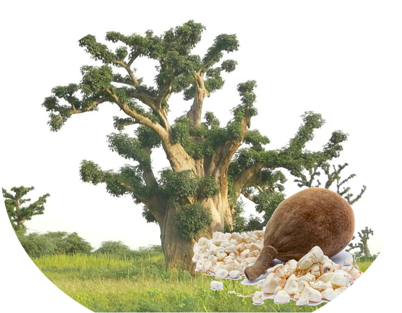
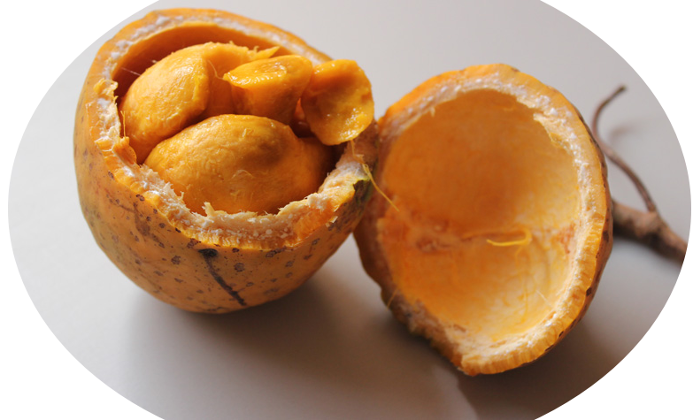
Baobab
The baobab tree is revered in Senegal, where it is the nation’s symbol. It is of very many benefits including; the bark is used to make ropes and baskets, the roots are ground down into a red powder and used as a dye and a remedy for malaria, and leaves as a vegetable. Oil extracted from seeds is used for inflamed gums and to ease the pain of diseased teeth. Leaves are used as a remedy for fever. The extract of baobab fruit pulp has significant liver-protecting properties and, as a consequence, the consumption of the pulp may play an important part in preventing liver damage in hepatitis.
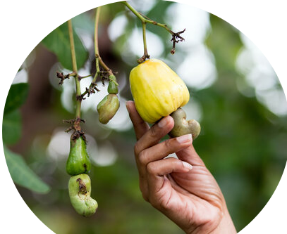
Cashew
In Senegal, most cashews are grown in Casamance producing 90% of the country's cashew nuts while smaller production areas are located in the regions of Fatick and Thies. Total production is about 26,000 tonnes but is increasing year-on-year.
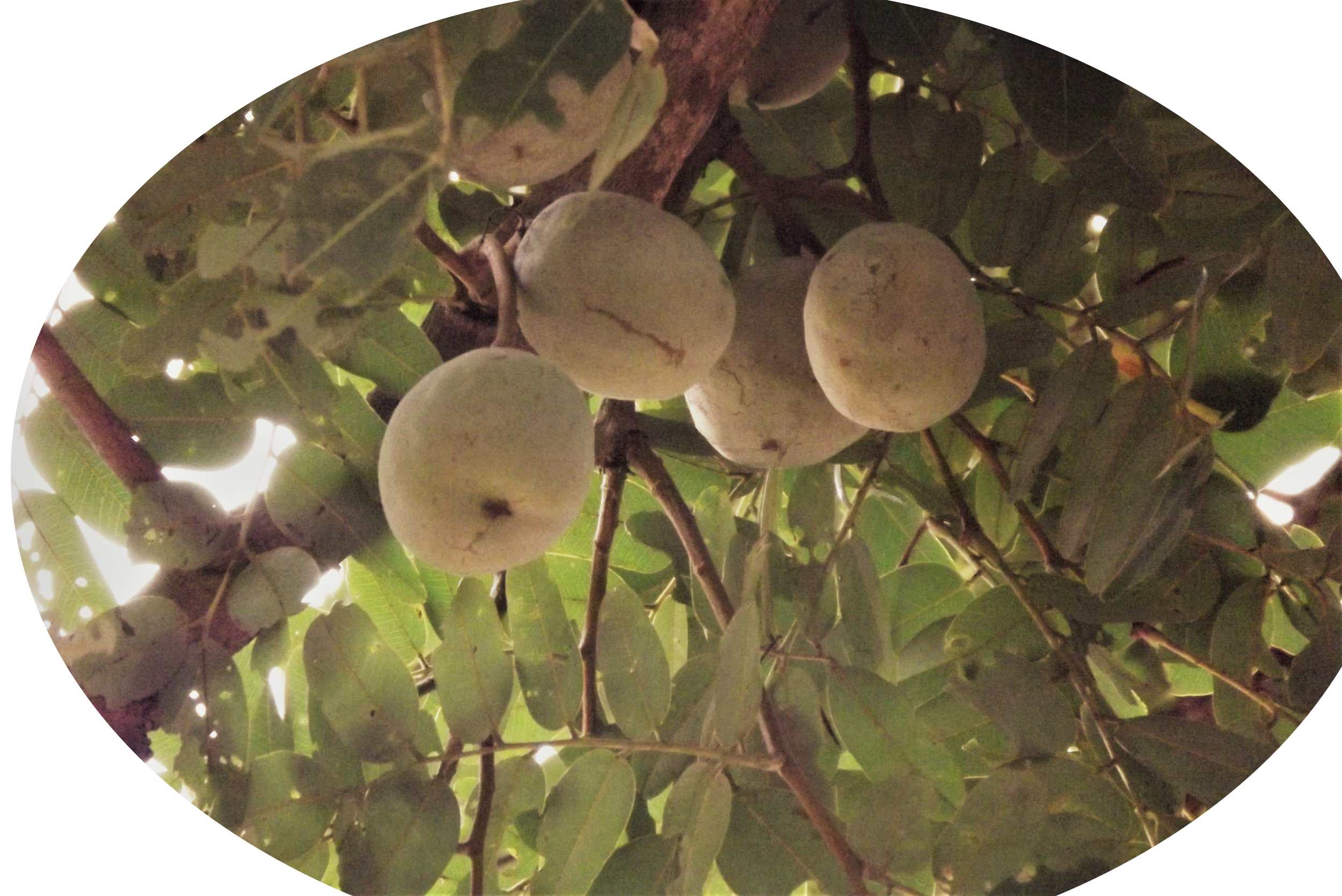
Ditakh
Is a leguminous tree that produces globular fruits. It is native to Senegal and the surrounding West African countries. The tree is of value for several reasons: the fruit is nutritious, locally prominent in folk medicine, source of quality timber. It could contribute to food security, sustainable land care, and rural development. It’s a key source of income for many families. It is mainly consumed in beverages or in ice cream and is naturally rich in vitamin C.
Madd
A tropical fruit that makes a popular ingredient in juices, jams, and ice creams. The plant is a climbing vine with tendrils that allow it to cling to the trunks and branches of trees in the forest, where it grows wild. Its flowers are very fragrant and white, yellowish or greenish-white. The fruits, orange when ripe, are ovoid, measuring up to 10 centimeters long and 8 centimeters wide, and are full of pulp-coated seeds. The fruits are rich in carbohydrates and vitamins A, K, and C. The forests in the Casamance are under threat from population growth, urban sprawl, and unfettered natural resource exploitation heightening the risks of flooding and erosion, posing a real threat to Madd.
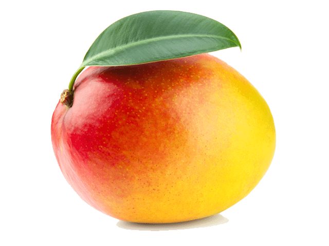
Mango
Senegal produces mangoes over a six-month period (from April to September) but the bulk of exports happens between July and August; most export varieties of Senegalese mangoes are cultivated in a 50-Km-radius northeast of Dakar (the Niayes area) and, going southwards, in the Petite Cote (Mbour), the Sine-Saloum region and the Casamance area which has a major production potential but is hampered by logistical isolation. In Senegal, the mango fruit is among the key agricultural exports of the country. The fruit is organically grown. Senegal produces more than 150,000 tons of mangoes annually but only 10% of this is exported.
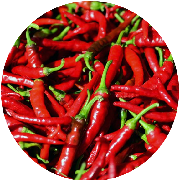
Pepper
Pepper is very important in any Senegalese diet. The production of pepper in Senegal was 14,823 tonnes in 2019 and is projected to change by an average of 1.5%. The country had approximately 2,025.00 hectares under pepper cultivation. In 2019, Senegal exported pepper costing 0.56m USD.
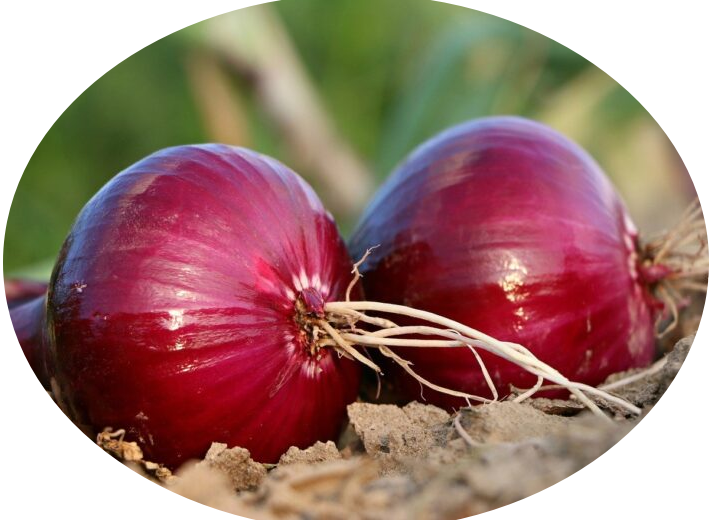
Onion
Onion is a cornerstone of Senegalese cuisine. Onion is the most dynamic horticultural crop in Senegal with a fourfold increase in production since 2001. With approximately 22,000 households involved in the production of onion, it is among the priority crops identified in both the country’s national development and growth strategy. Okra: Immature capsules of the plant are harvested 4-9 days after anthesis before they lignify. They are eaten fresh or dried, like condiments or added to soups. At full maturity, fruits become lignified and, in some varieties, shed their seeds. Some parts of the plant are also used in the textile industry.
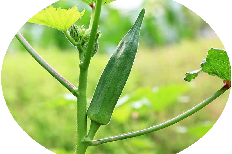
Okra
Immature capsules of Okra are harvested 4-9 days after anthesis before they lignify. They are eaten fresh or dried, like condiments or added to soups. At full maturity, fruits become lignified and, in some varieties, shed their seeds. Some parts of the plant are also used in the textile industry.
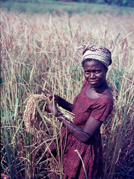
Rice
Rice production systems in Senegal are largely dominated by small and family-held farms. There are also two quite distinct types of rice growing: irrigated rice farming in the Senegal River Valley and in the Anambé basin on the one hand, and the rainfed lowland or upland rice farming in the southern regions of Fatick, Zinguichor, Sédhiou, Kolda, Tambacounda and Kédougou on the other. Major cause of reduced rice production in the irrigated types and lowland rice is acidification and soil salinization. Senegalese rice production covers around 30% of the local demand (436 000 tons of paddy rice which equals to 283 000 tons of white rice.
Climate vulnerability assessment report for Senegal
The vulnerability assessment for the selected crops in Senegal is based on their sensitivity to change, their exposure, and their adaptive capacities. The ultimate purpose of this study is to assess if the future climate has a neutral, negative or positive (no change/decrease/increase) impact on crop productivity, and to identify regions of concern and opportunities for climate change adaptation. See the report below:
MEDA'S Approach to acheiving AVENIR's GOALS
In acheiving its goal of improving the socio-economic well-being and resilience of farming households in the regions of Tambacounda and Sedhiou, focusing on women and young people, AVENIR focuses on three important areas.
Increase socio-economic empowerment of
women and young people.
AVENIR will bring about interventions for economic empowerment focusing on improving incomes and opportunities using selected value chains while developing critical leadership and soft skills.
Of high importance will be to increase the capacity of women and youth to profitably operate agribusinesses in selected climate-change-adapted value chains and improve market access.


Promote sustainable and innovative intensification of irrigated and climate-change adapted crops.
AVENIR will prioritize climate-smart agriculture and irrigation systems to improve Livelihoods, especially for women and youth. This will improve the integration of agriculture development and climate responsiveness.
AVENIR will also improve access to agriculture and irrigation inputs, technologies, and techniques, and increase the capacity of input and service providers to disseminate products and services that promote sustainable intensification of selected climate-change adapted crops to farmers.

Improve sustainable and equitable local governance and territorial management of water resources.
This will focus on improving governance and management of water resources, working with government, civic groups and market actors. This will involve apacity building activities and stakeholder dialogues to increase capacities of local/territorial actors in the management of water resources sustainably and equitably.
Implementing Partners

Funders